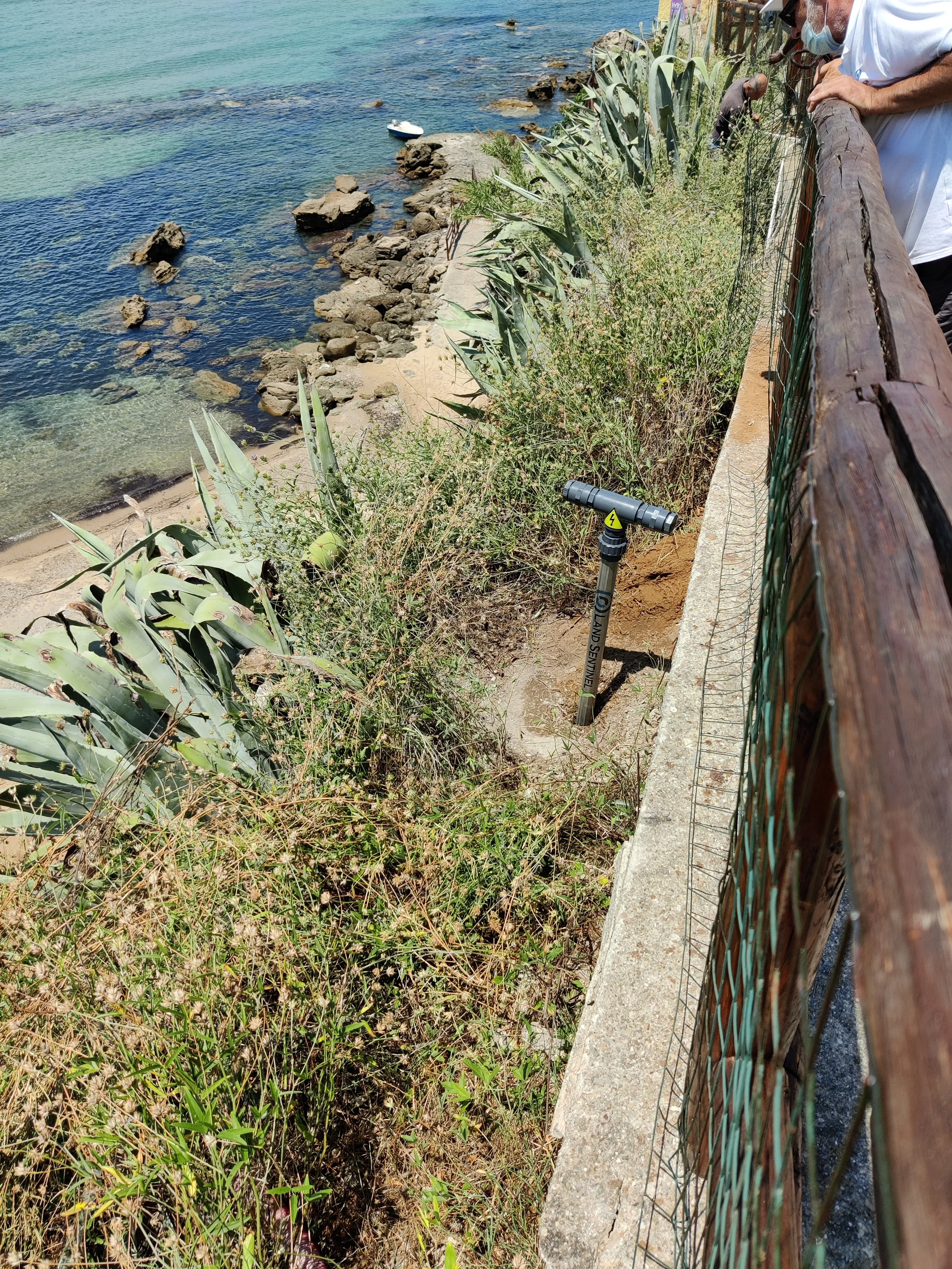
A modular chain of accelerometers with an integrated piezometer at the lower end and, optionally, a satellite target at the top: tilt, temperature, and groundwater level on a single instrumented chain, up to 50 m. Designed for real-time monitoring of high hydrogeological risk situations, landslides, embankments, and unstable slopes, for the prompt activation of alerts for civil protection and emergency response teams.
Sentinel Slim is a modular chain of accelerometers, distributed along a structural tube up to 50 m long, with an integrated piezometer at the bottom of the instrument for groundwater level monitoring. Each module continuously measures tilt and temperature, transmitting data to the cloud with automatic threshold alerts. It requires no scheduled maintenance.
Two models, one platform
The chain is configured with 2 axes (X, Y) or 3 axes (X, Y, Z), depending on whether tilt needs to be monitored on a single plane or including out-of-plane rotations. The rest of the system, electronics and software, stays the same.
One chain, many measurement points
Up to 8 biaxial accelerometer modules, or 5 triaxial modules, connected on the same chain, each with an integrated temperature sensor. The piezometer at the bottom of the chain adds piezometric level measurement, and the top of the instrument can integrate a satellite target for GNSS monitoring.
Data Transmission
Data is transmitted via NB-IoT to the cloud, with configuration and firmware updates via Bluetooth (BLE). The system integrates with third-party MQTT brokers or TCP servers.
01/Tube structure
Up to 4 m
Ø 20 mm
Over 4 m
Ø 26 mm (first 6 m) + Ø 20 mm
Modules
2 m each
Assembled with crimp connectors
02/Monitored quantities
Tilt2 or 3 axes depending on the model · 0.02° accuracy
TemperatureUp to 3 thermometric sensors along the chain
Groundwater levelPiezometer at the lower end of the instrument
03/Data transmission
Sensors → electronic unitAccelerometer modules, thermometric sensors and piezometer connected to the acquisition unit at the top of the chain, with pre-assembled protected cables inside the tube.
Unit → cloud platformTransmission over NB-IoT (MQTT / TCP protocol). Optionally, a satellite target on the head for sites without cellular coverage.
ConfigurationFrom a mobile app over Bluetooth or remotely. The platform allows alert and alarm thresholds to be set.
Installation is carried out using light drilling, performed with a compact, easily transportable machine: no heavy construction drill rig required.
04/Technical specifications
Battery life Power is chosen between a high-capacity battery, a battery with solar panel, or external supply. Battery life is sized to the configuration and the data transmission rate; it is not a fixed value.
Mechanical structure
Tube type
Multilayer PEX/Al/PE
Diameter
Ø 20 mm up to 4 m; Ø 26 mm (first 6 m) + Ø 20 mm over 4 m
Maximum length
Up to 50 m
Standard module length
2 m
Protection rating
IP67 (IEC 60529)
Measuring sensors
Accelerometer modules
GY-61 / ADXL335 — capacitive MEMS, ±3 g
Angular accuracy
0.02°
Thermometric sensors
Up to 3 along the chain
Piezometer
At the lower end — MISSING DATA (range, resolution, depth)
Electronic transmission unit
Connectivity
NB-IoT (BC660K-GL module) + Bluetooth 5.1 (BLE)
Uplink protocol
MQTT / MQTTs / TCP / UDP
Satellite target
Optional, on the head — MISSING DATA (specifications)
Standby consumption
10 µA @ 3.3 V
Operating conditions
Operating temperature
−30 °C / +70 °C
Relative humidity
0–100 % (condensing)
Compliance
Marking
CE
RED Directive
2014/53/EU
RoHS
Compliant
Country of origin
Italy
05/Typical applications
Embankments and levees
Unstable slopes and ground
Retaining walls and hydraulic works
Landslide-risk areas (alerts to response teams)
Let's talk about your monitoring project
Tell us about the structure to monitor: we will propose the best-suited configuration.